Southeast tornado outbreak — October 10–11, 2026
32 preliminary tornado reports and 55 tornado warnings across Georgia, South Carolina, North Carolina on October 10–11, 2026: replay the radar, the warnings and every reported tornado on the map, and compare Sentinel-2 satellite images from before and after. Press ▶ Play: the radar, the warning polygons and the tornadoes roll across the map exactly as they happened.
Tornado paths from space
Sentinel satellite images laid onto the map at their true position along every linked tornado path — with the tornadoes replaying on top in real time. Use the big map for the whole outbreak (zoom in to load the 10 m imagery, or jump to a hotspot), or switch to the side-by-side / stacked close-ups of the hardest-hit spots. Compare before and after, or the radar change map that sees through clouds.
56 Sentinel-2 tiles (about 14 × 16 km each, 10 m per pixel) cover every linked tornado path. Each tile uses its most recent clear pass before the storm (2026-09-29 – 2026-10-08); the “after” and radar-change layers fill in tile by tile as clear passes arrive.
5 WNW Oliver, GA · 2 SSE Hunters, GA · 1 NW Newington, GA · 2 NW Newington, GA
5 tornado reports in and around this 15.3 × 15.3 km Sentinel-2 frame (10 m per pixel); the red line continues along the linked reports beyond it. The funnel replays them in real time; the shaded band is a schematic ~200 m damage corridor between the report points, not a surveyed track. The radar-change layer compares Sentinel-1 passes from 2026-09-30 and 2026-10-24 (same orbit): red marks forest where the radar return dropped by 3 dB or more — typical of snapped and uprooted trees.
6 SSW Appleton, SC · 5 SSW Appleton, SC · 3 N Appleton, SC · 3 NNE Appleton, SC
6 tornado reports in and around this 16 × 16 km Sentinel-2 frame (10 m per pixel); the red line continues along the linked reports beyond it. The funnel replays them in real time; the shaded band is a schematic ~200 m damage corridor between the report points, not a surveyed track. The radar-change layer compares Sentinel-1 passes from 2026-09-30 and 2026-10-24 (same orbit): red marks forest where the radar return dropped by 3 dB or more — typical of snapped and uprooted trees.
Before and after — quick compare
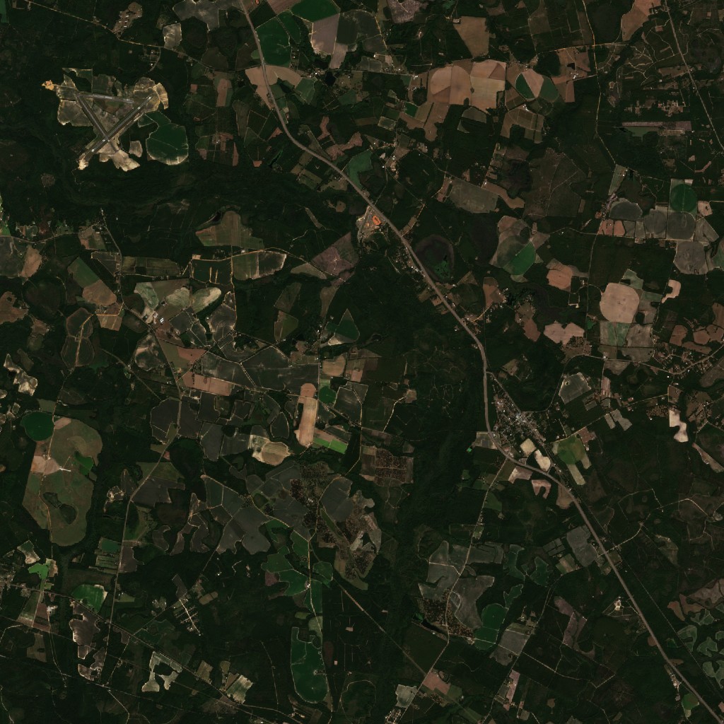
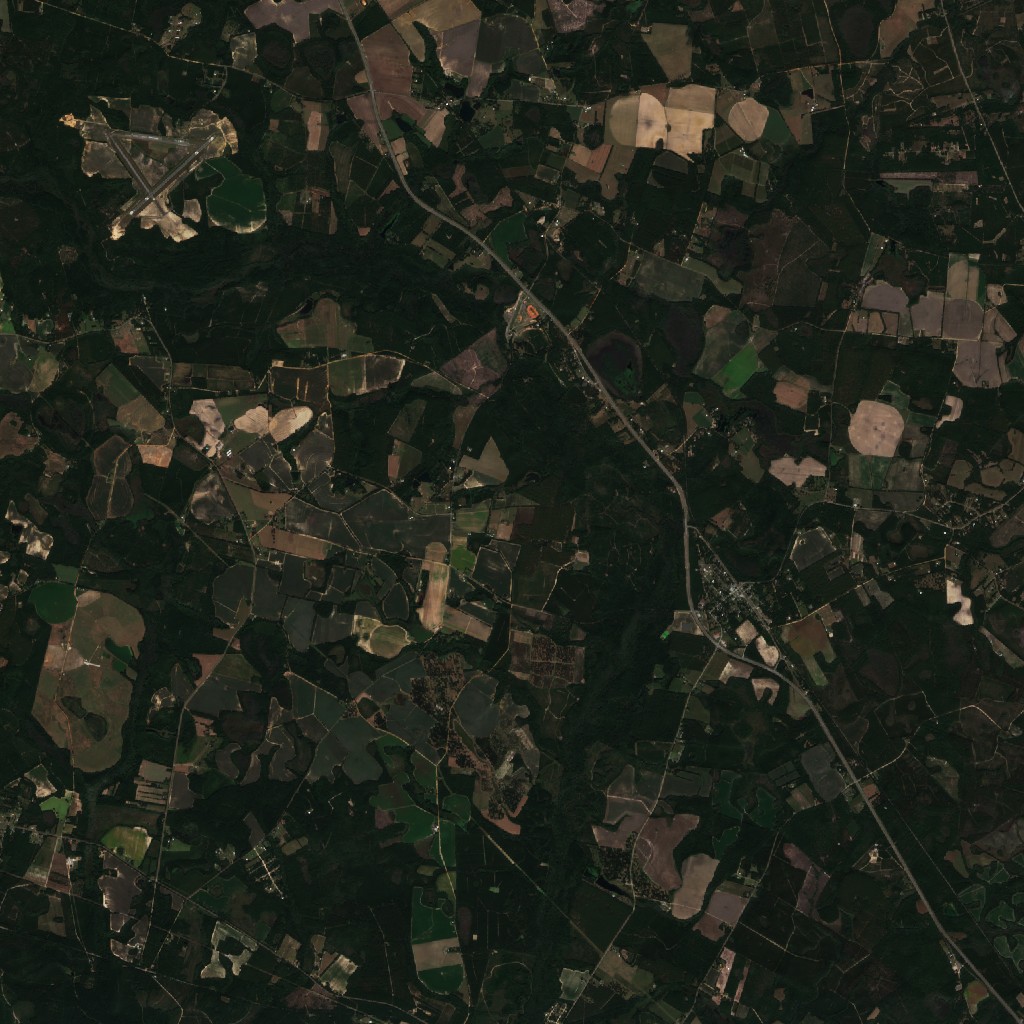 before · 2026-10-01after · 2026-10-14
5 WNW Oliver, GA · 2 SSE Hunters, GA · 1 NW Newington, GA · 2 NW Newington, GA
5 tornado reports within this 15.3 × 15.3 km frame (yellow dots). Strong (EF2+) tornadoes through forest leave a visible scar; weaker ones over fields often don't.
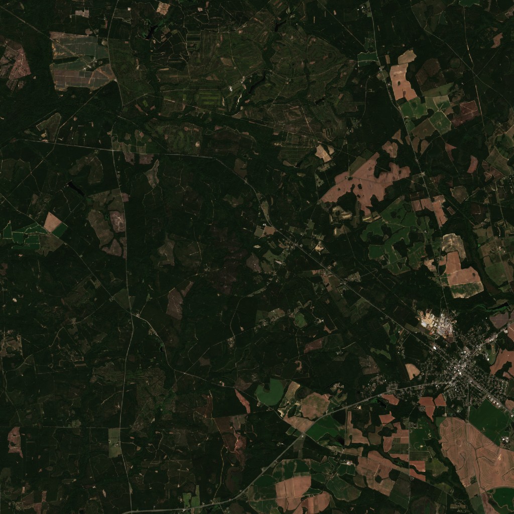
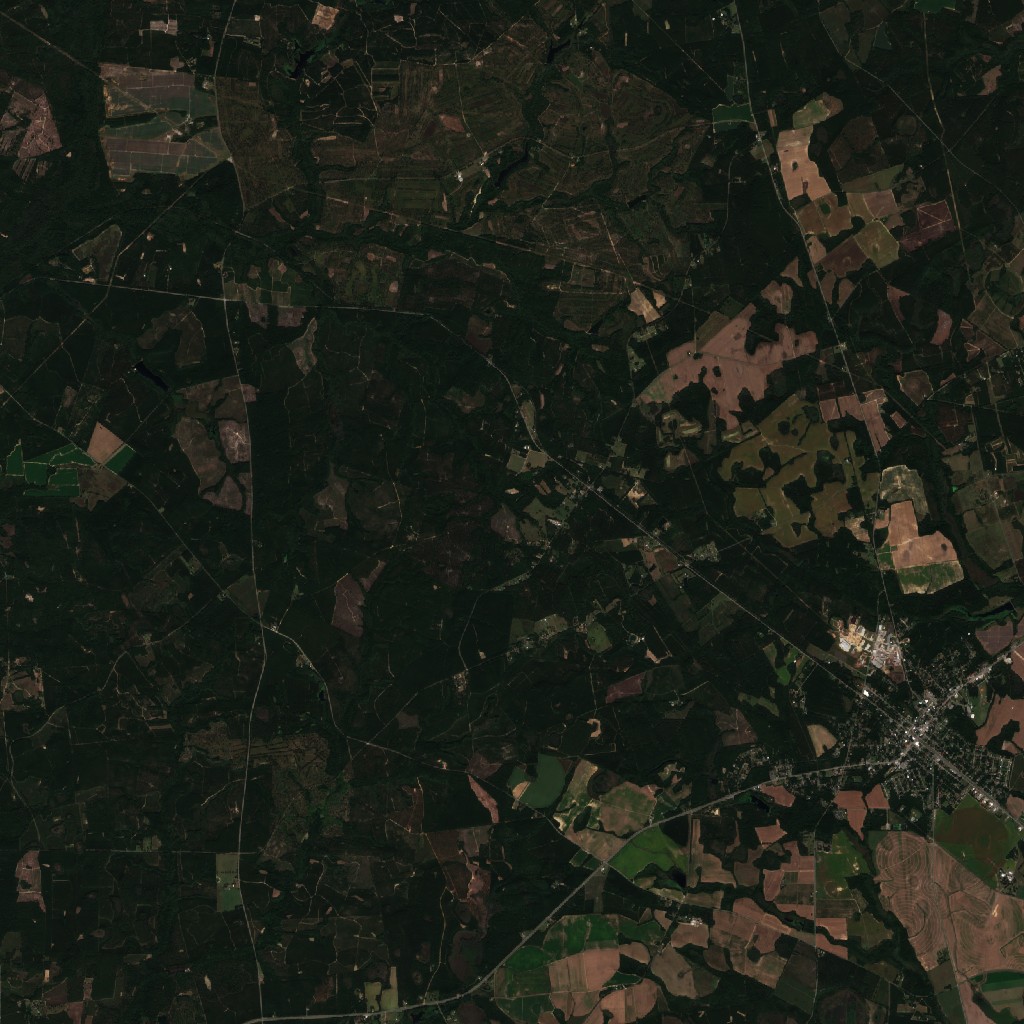 before · 2026-10-01after · 2026-10-14
6 SSW Appleton, SC · 5 SSW Appleton, SC · 3 N Appleton, SC · 3 NNE Appleton, SC
5 tornado reports within this 16 × 16 km frame (yellow dots). Strong (EF2+) tornadoes through forest leave a visible scar; weaker ones over fields often don't.
Contains modified Copernicus Sentinel data 2026, processed by the Copernicus Data Space Ecosystem. 10 m resolution, true color.
Hour by hour
■ tornado reports per hour · ■ tornado warnings in effect (hover a bar for the exact numbers)
Tornado reports by state
| North Carolina | 16 | |
| South Carolina | 10 | |
| Georgia | 6 |
Warnings by NWS office — and their damage surveys
| Office | Warnings | |
|---|---|---|
| Raleigh NC | 19 | office page → |
| Columbia SC | 13 | office page → |
| Wilmington NC | 11 | office page → |
| Charleston SC | 7 | office page → |
| Newport/Morehead City NC | 4 | office page → |
| Peachtree City GA | 1 | office page → |
Final tornado ratings (EF-scale) and track maps come from these offices' damage surveys, usually within a few days — also on the NWS Damage Assessment Toolkit.
Damage reported
19:17 UTC · click to see it on the map
19:20 UTC · click to see it on the map
19:27 UTC · click to see it on the map
19:36 UTC · click to see it on the map
20:17 UTC · click to see it on the map
20:19 UTC · click to see it on the map
20:47 UTC · click to see it on the map
21:10 UTC · click to see it on the map
21:15 UTC · click to see it on the map
10:06 UTC · click to see it on the map
14:14 UTC · click to see it on the map
15:58 UTC · click to see it on the map
16:07 UTC · click to see it on the map
Every reported tornado
Preliminary local storm reports from the NOAA Storm Prediction Center; one tornado is often reported several times. Final EF-ratings come from NWS damage surveys. Click a report to see that moment on the map.
More
See today's live tornado map, other replayed outbreaks, or the hail map.
This site was built by Digital Dynamics Kft.
We build live, data-driven sites like this one
This replay is our own work, built from openly available data — the archived radar, the warning polygons, the storm reports and the Sentinel satellite images laid onto our own map tiles, served from the European Union. If your business generates data — measurements, machines, orders, customers — we are happy to turn it into a clear, interactive interface.
But this is not all we build:
- online shops and websites, with a design of your own
- SaaS products and ERP systems
- mobile apps for Android and iPhone
- data collection, automation and map-based visualization
Or anything else that can be programmed — just get in touch.
See our work → or write: info@digitaldynamics.hu