Hurricane tracker — live
Norbert
58 mph / 93 km/hTropical Storm · East Pacific · 999 hPa
moving WNW at 10 mph ·
official NHC advisory →
5-day forecast track (9 points)
| 5:00 AM Sat | 58 mph | tropical storm |
| 2:00 PM Sat | 63 mph | tropical storm |
| 2:00 AM Sun | 63 mph | tropical storm |
| 2:00 PM Sun | 58 mph | tropical storm |
| 2:00 AM Mon | 52 mph | tropical storm |
| 2:00 PM Mon | 46 mph | tropical storm |
| 2:00 AM Tue | 40 mph | tropical storm |
| 2:00 AM Wed | 35 mph | depression |
| 2:00 AM Thu | 29 mph | depression |
Official NHC forecast points — intensities are maximum sustained winds.
Positions from the latest NOAA National Hurricane Center advisories. Circle size and color follow the Saffir–Simpson category. The shaded, dashed area is the official NHC forecast cone (days 1–5): the storm center is expected to stay inside it about two-thirds of the time — impacts regularly reach beyond the cone. Small dots mark the forecast positions; hover them for the expected wind speed at each step. For watches and warnings always consult the linked NHC advisory pages.
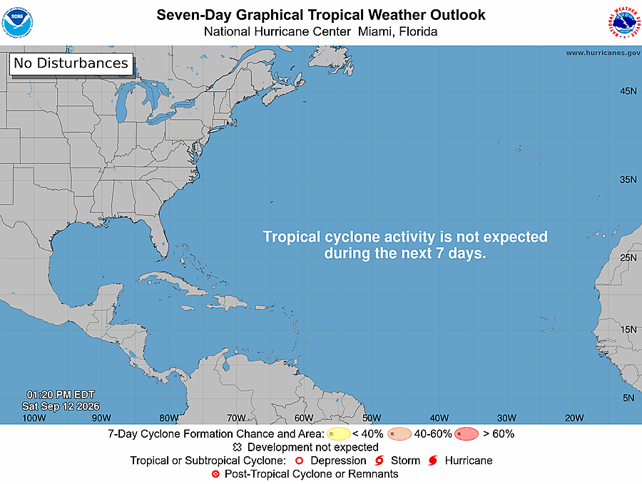
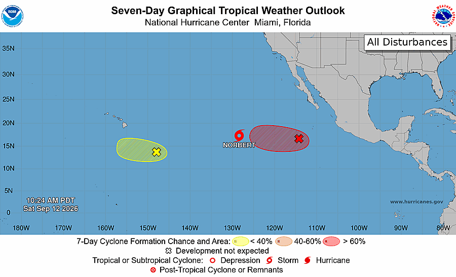
Where might the next storm form? — 7-day outlook
The National Hurricane Center's genesis outlook: shaded areas show where a tropical system may develop within 7 days (yellow <40%, orange 40–60%, red >60%). We mirror the official charts every 30 minutes.
The Saffir–Simpson scale — what each category means
| Category | Winds | What it does |
|---|---|---|
| TS | 39–73 mph | Tropical storm — broken branches, local flooding; already dangerous at sea. |
| 1 | 74–95 mph | Roof and siding damage, snapped branches, power outages for days. |
| 2 | 96–110 mph | Major roof damage, shallow-rooted trees down, near-total power loss. |
| 3 | 111–129 mph | Major hurricane — structural damage to well-built homes, water and power out for weeks. |
| 4 | 130–156 mph | Catastrophic — most trees snapped, areas uninhabitable for weeks or months. |
| 5 | 157+ mph | Total roof failure and wall collapse on many homes; long-term evacuation. |
The scale measures wind only — historically, most hurricane deaths come from water: storm surge and inland flooding. That is why a weakening storm can still be the deadliest one.
Frequently asked questions
When is hurricane season?
Atlantic: June 1 – November 30, peaking mid-August to mid-October. Eastern Pacific: from May 15. Out-of-season storms happen, and this page keeps watching year-round.
What do the categories mean?
The Saffir–Simpson scale rates sustained winds: Cat 1 from 74 mph, Cat 2 from 96, Cat 3 (major) from 111, Cat 4 from 130, Cat 5 above 157 mph. Tropical storms are 39–73 mph.
Where does the data come from?
From the NOAA National Hurricane Center's public feeds — the official U.S. source for Atlantic and Eastern Pacific tropical cyclones, in the public domain. We refresh every 30 minutes; for life-safety decisions always use the NHC advisories directly.